

A Master’s Touch: Restoring the Traditional Art of Polynesian Navigation
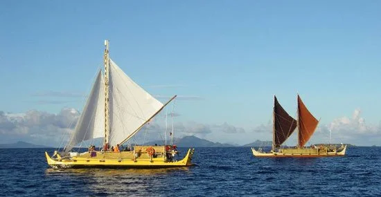
Alingno Maisu and Hokuleʻa heads towards Satawal, Micronesia, 2007 – Photo courtesy of hokulea.com
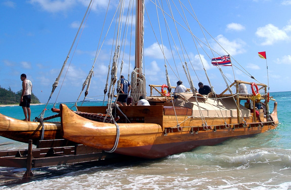
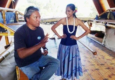
The following blog was taken from an in-depth interview with Master Carver and Polynesian Navigator, Kawika Eskaran of Lāʻie, Hawaiʻi, who, along with Sione Tuione Pulotu, guided the design and construction of the Iosepa, a 57′ double-hulled sailing canoe modeled in style and function after the ancient canoes utilized by Hawaiians to travel the seas.
The Iosepa was sponsored and built through a cooperative effort between Brigham Young University – Hawaiʻi and The Polynesian Cultural Center. When it is not sailing, the Iosepa is housed at The Polynesian Cultural Center.
Traditional Polynesian Navigation

Kawika describes the navigational skills used during a historic trip taken in 2007, where they delivered the Alingano Maisu, a handcrafted, large canoe built in the ancient Polynesian style, to “Papa” Mau Pialug as a gift for his invaluable contributions in reawakening the knowledge of wayfinding or non-instrument navigation among the Hawaiians and other Polynesians. The sister ship on this voyage was the Hōkūleʻa.
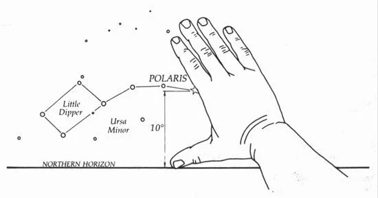
In navigating by the stars, you use certain sections of the Heavens as the sky rotates in the evening. There are different starlines that come up and others that are set.
The measuring points for this system are your own digits on your hand and the spacing between them in reference to the layout of the constellations. Once you calibrate your hand size, you utilize your hand to get exact bearings throughout the evening.
A hands-on experience
Kawika explained how this worked. Imagine the horizon of the ocean before you. As you are sailing, you would use the North Star as your reference point. At the point we were sailing near the equator, the North Star was six degrees above the horizon.
We calibrated our hands before we left home,
he said, while extending his arm to full length in front of him, and placing his right hand with the palm out and with his thumb extended. From the bottom of my hand here to the center of my fingers here is six degrees. For me, that is roughly two degrees per finger.
So, I placed the bottom of my hand on the horizon,
he continued, and then looked for the North Star. I would then place the star right at that point on my fingers that equaled six degrees. Then throughout the night, I would make sure that we are on that mark.
A team effort
Now, say the wind is blowing, and the canoe is always wanting to come up into the wind
, Kawika continued. Sometimes, to keep our mark, we would want the canoe to stay downwind. So all night long you’re fighting the wind, and the want of the canoe to head into that wind. To counter this, you’ll always be trying to steer it down. Sometimes the currents actually work with you too much, and you end up going too far down, through steering.
To measure correctly
, Kawika demonstrated, I would need to square my shoulders to the canoe, with my nose straight forward. So as long as my hand is pointing to the North Star, we will be good. If we start falling down and start pointing into the wind, my hand will be off-center, and I will say, bring the canoe up.
Kawika shared that six individuals besides himself, traveling on the Hōkūleʻa and Alingano Maisu, were assigned each night to keep individual measurements, assuring that the two vessels kept on course.
Learn more at The PCC
Want to learn more about the knowledge and skills our Polynesian ancestors used to travel the seas? Come see the mighty Iosepa (E-yo-se-pah), a double-hulled Polynesian vessel designed and built to ancient specifications at Brigham Young University – Hawaii and housed at the adjoining Polynesian Cultural Center.